The drive from Flagstaff to Sedona is one of the most beautiful drives in the American Southwest.
From the peaceful Ponderosa Pine forests surrounding Oak Creek to the always stunning red rock formations of Sedona, there is plenty to see and do on the drive from Flagstaff to Sedona.
During one of my recent visits to northern Arizona, I spent several days making all the stops I could along Arizona’s State Route 89A, the road that connects Sedona to Flagstaff.
State Route 89A winds alongside Oak Creek Canyon all the way from Flagstaff to Sedona. Along the way you’ll find peaceful hiking trails, overlook vistas, and popular state parks offering iconic Sedona views.
This itinerary is a great option for those checking out of a hotel in Flagstaff, or leaving the Grand Canyon, with some time to burn before checking in at a hotel in Sedona.
In fact, many of the stops on this itinerary include some of the most popular things to do in Sedona. So essentially, you’re just getting a head start on your Sedona vacation and using your time wisely.
In this Flagstaff to Sedona road trip itinerary I share all the best stops to make along the way, and what to expect at each location.
Some of the links in the post are affiliate links. If you make a purchase through these links it helps to support this site at no extra cost to you.
Flagstaff to Sedona Drive
In this post I’m sharing all the best stops on the Flagstaff to Sedona scenic route along the 89A heading south towards Sedona out of Flagstaff.
The distance from Flagstaff to Sedona is just 29 miles and about 48 minutes.
Down below I identify each of the stops as you’ll encounter them from north to south along the 89A between Flagstaff and Sedona. I also include the distance between each stop and what the parking situation is like at each location.
For reference, here are the driving distances between popular destinations in the area.
- Flagstaff to Sedona: 48 minutes / 29 miles
- Grand Canyon National Park to Flagstaff: 90 minutes / 79 miles
- Sedona to Grand Canyon National Park: 2 hours 10 minutes / 114 miles
- Phoenix to Sedona: 2 hours / 116 miles
- Scottsdale to Sedona: 2 hours 7 minutes / 125 miles
Driving directions between each of the stops below can easily be found using Google Maps.
Excluding Flagstaff and Sedona, there are nine (9) stops you can make along the way. It took me two days to visit each of these stops.
Since some of the stops are strenuous hikes of several miles or longer, I’d like to point out that I did not complete the full distance on each of these hikes during my visit.
If you’re planning on completing the full length of any of the hikes (with the exception of the first one which is quite short), you’ll need more than two days to complete all the stops below.
Flagstaff to Sedona Road Trip YouTube Video
If you’d like to get this blog post in video form you can watch my YouTube video linked above.
While this was a Grand Canyon to Sedona road trip video, the majority of the video focuses on the stops between Flagstaff and Sedona.
1. Flagstaff
Flagstaff is a popular jumping off point for those visiting nearby destinations like the Grand Canyon, Horseshoe Bend, or Sedona.
There are even Flagstaff to Grand Canyon tours departing from local hotels if you prefer not to make the drive yourself. Honestly, you can see a lot with just a Grand Canyon day trip. Though if you have more time, I would spend atleast two days at the Grand Canyon if you can.
Those spending some time in Flagstaff will definitely want to get out and explore the city. Some of the best things to do in Flagstaff include visiting the historic city center, go stargazing at Lowell Observatory, and take the scenic gondola ride at Snowbowl.
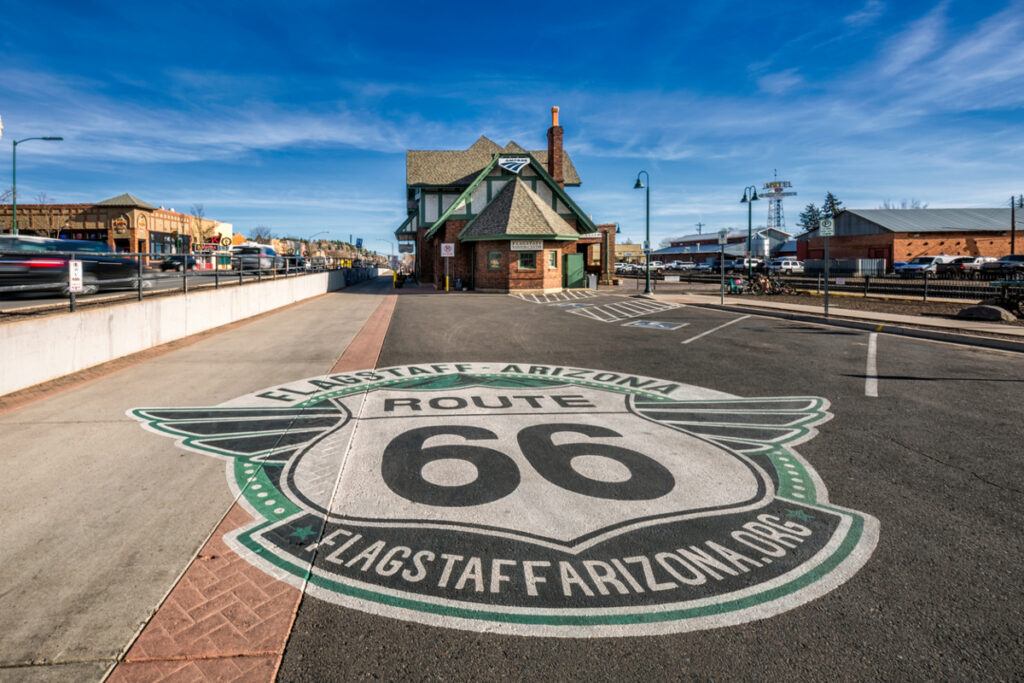
I also recommend spending some time visiting the unique bars, restaurants, and museums along the section of historic Route 66 that runs through Flagstaff. You’ll find plenty of great photo opportunities here too.
Another popular thing to do in the area is visit the Arizona Meteor Crater located about 45 minutes east of Flagstaff. This is a natural landmark and the site of a meteor crater impact thousands of years ago.
You can also plan a visit to nearby Williams, Arizona located about 35 minutes west of Flagstaff. Williams is home to the infamous Grand Canyon Railway where you can ride a train all the way to the South Rim of the Grand Canyon.
Distance from Flagstaff to Griffiths Spring Trail: 15 minutes / 7.5 miles
2. Griffiths Spring Trail
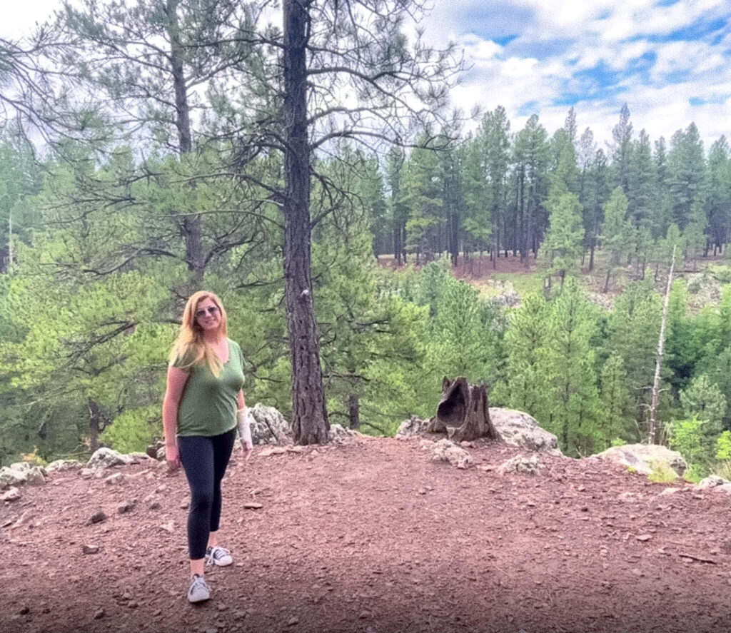
The Griffiths Spring Trail is an easy and flat one mile hike located in the Coconino National Forest.
The trail winds in a circle through a Ponderosa Pine forest and can be easily completed in about 20 to 30 minutes depending on your pace.
I arrived just after 6:00 a.m. and had the trail mostly to myself. It’s quiet, peaceful, and a pleasant way to start your day. This hike is easy enough that you can bring your coffee with you to sip along the way.
Hours / Access: Gate is open from 6:00 a.m. to 10:00 p.m.
Parking Situation: There are several parking spaces located down a packed dirt road. You’ll only need to drive a few hundred feet off the main road to reach the parking spaces. I drive a Fiat 500 and my vehicle did just fine. Parking is free.
Distance from Griffiths Spring Trail to Oak Creek Vista: 10 minutes / 6.4 miles
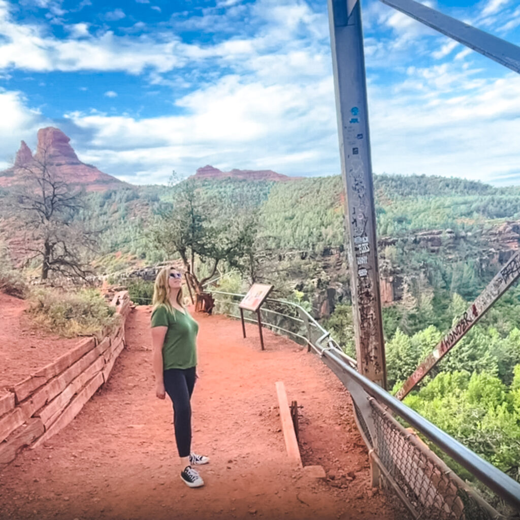
3. Oak Creek Vista
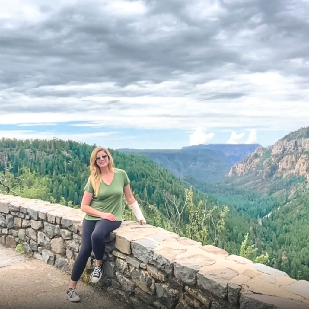
Oak Creek Vista is a relatively quick stop but well worth the views. From the various overlook points you’ll get sweeping views of Oak Creek Canyon and Sedona off in the distance.
The overlook area is also the perfect place for photos, so don’t forget your camera.
There are also Native American arts, crafts, and jewelry for sale along the walkway past the parking area.
Hours / Access: Gate is open from 9:00 a.m. to 4:00 p.m.
Parking Situation: Parking is free and there is plenty of parking in the paved lot.
Distance from Oak Creek Vista to Harding Springs Trail: 9 minutes / 6.6 miles
4. Harding Springs Trail
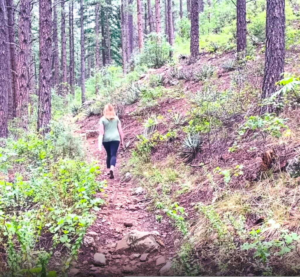
Harding Springs Trail is a moderately difficult 1.4 mile out and back trail through a peaceful forested area.
The trail starts off with an incline and some loose rocks, so be sure to wear good hiking shoes for this trail. It is estimated the hike can be completed in about 90 minutes. Dogs are welcome if on leash.
Hours / Access: 24 hours
Parking Situation: There is free parking in a packed dirt lot on the right hand side of the road. There are only a handful of spots, so arrive early. The trail head is on the opposite side of the road.
Distance from Harding Springs Trail to West Fork Oak Creek Trail: 3 minutes / 1.2 miles
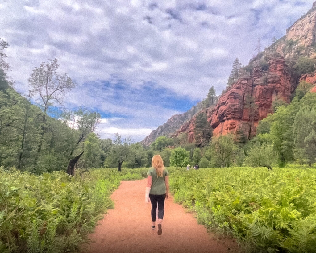
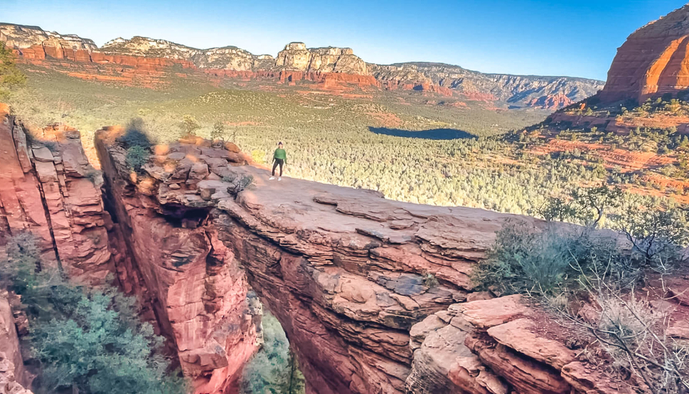
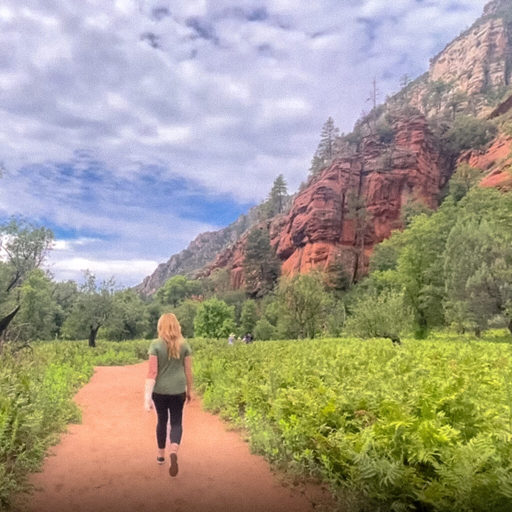
5. West Fork Oak Creek Trail
The West Fork Oak Creek Trail is located in the Coconino National Forest and is one of Sedona’s most popular hikes, it’s also one of my favorites.
The hike starts off with incredible views right from the start and is the perfect hike any time of year.
The West Fork Oak Creek Trail runs 14 miles from end to end but is maintained for just the first three miles. Sections of this trail require you to hop over rocks and boulders to cross the stream, but most early crossings are fairly easy.
Further down the trail there may be some sections which require you to step into the water, so water shoes are recommended if you plan to hike the entire length of the trail.
Hours / Access: The park is open daily from 8:00 a.m. to dusk.
Parking Situation: There is a paid lot on the right hand side of the road. Parking is $11 per vehicle.
Distance from West Fork Oak Creek Trail to Slide Rock State Park: 7 minutes / 3.7 miles
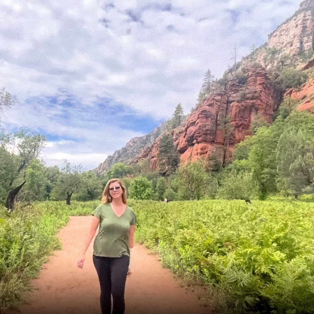
6. Slide Rock State Park
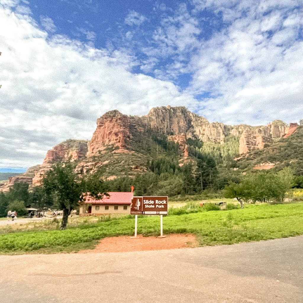
Slide Rock State Park is one of the most popular attractions in Sedona. The park itself is surrounded by towering red rock formations greeting park visitors with beautiful views on arrival.
The main attraction in the park is the swimming area situated along Oak Creek. As the name of the park suggests, there is a natural water slide that was formed in Oak Creek, which is very popular with local kids.
The park fills up quickly on weekends with local families bringing chairs, blankets, and coolers and setting up camp along the water.
My best advice is to arrive early, as close to opening as possible. This will ensure you get into the park and are able to find a good spot to sit along the water.
Hours / Access: Hours vary depending on season and day of the week. Generally open from 8:00 a.m. to 6:00 p.m. or 9:00 a.m. to 5:00 p.m. Check the Slide Rock State Park website prior to your visit.
Parking Situation: Admission per vehicle varies between $10 and $30 depending on season and day of the week. Details available on the Slide Rock State Park website linked above. There are many parking spots but the lot often fills up and vehicles will queue in a line. Wait times can be VERY long.
Distance from Slide Rock State Park to Sterling Pass Trail: 1 minute / 0.7 miles
7. Sterling Pass Trail
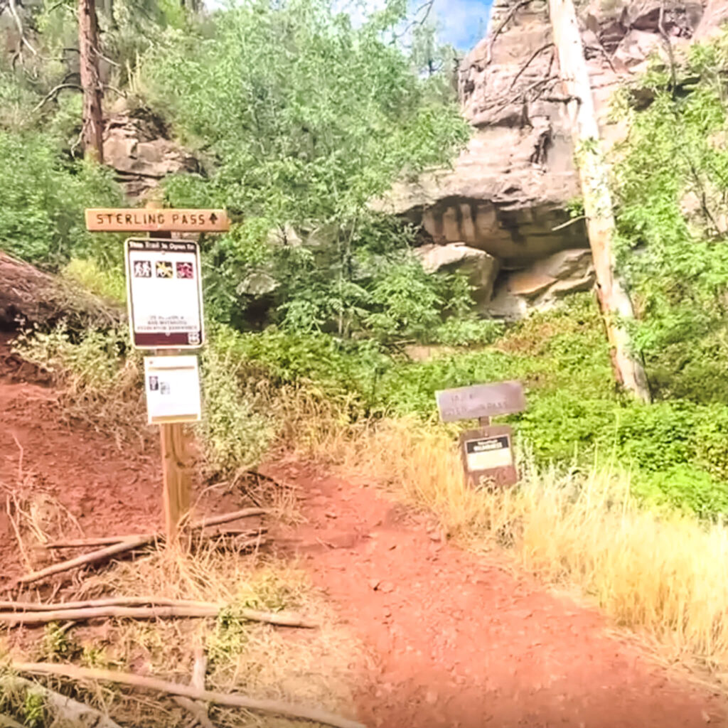
Not gonna lie, Sterling Pass Trail is quite the adventure right from the start. You’ll be immediately greeted with a steep climb and relatively narrow path along a cliff. If you have an issue with heights, this may not be the hike for you.
Sterling Pass Trail is a 5.1 mile out and back hike and is considered challenging. Comments from past hikers on Alltrails include: “Challenging with beautiful views,.” “Intense elevation gain,.” and my personal favorite, “HARD! Bring hiking sticks and courage.”
Amusing commentary aside, this is a popular hike and you’ll likely encounter many other hikers. Be sure to bring lots of water for this one. This hike is estimated to take about 3 hours 30 minutes to complete.
Hours / Access: 24 hours
Parking Situation: There is free parking along the side of the road. You’ll want to arrive early to find a spot. I parked down the road a bit and had to walk back about 0.25 mile.
Distance from Sterling Pass Trail to North Wilson Trail: 2 minutes / 1.2 miles
8. North Wilson Trail
The North Wilson Trail is a 9.5 mile out and back hike that leads to a beautiful lookout point. This is a dog friendly trail (on leash only) and is considered a challenging hike.
According to past hikers it takes about 5 hours and 30 minutes to complete the hike. From the lookout point you’ll be rewarded with views of Sedona, Coffee Pot Rock, Capitol Butte, Oak Creek Canyon, Sterling Canyon and Verde Valley.
You’ll want to start this hike early especially in the warmer months to beat the midday heat.
Hours / Access: 24 hours
Parking Situation: There is free parking along the side of the road. There is also a large lot which requires the Red Rocks Pass.
Distance from North Wilson Trail to Grasshopper Point: 7 minutes / 3.1 miles
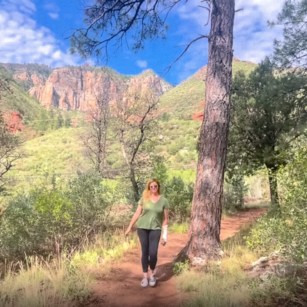
9. Grasshopper Point
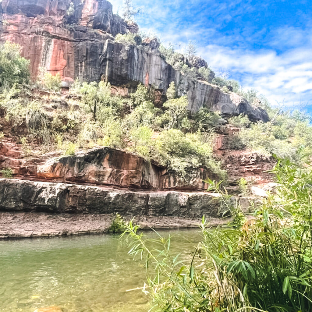
Grasshopper Point is a popular picnic and swimming area with access to several local hiking trails. The swimming area is pictured above.
It is common to see locals cliff jumping off the surrounding rock formations. Please note that this activity is discouraged due to varying water depths and the abundance of rocks and boulders in the water.
I didn’t personally go in the water as I had a cast on my arm at the time, but I was told the water is deeper than it looks. I just took their word for it.
Allen’s Bend Trail and Casner’s Trail are both located in the area. Allen’s Bend Trail begins at the picnic area and runs parallel to the creek. Casner’s Trail begins at the end of Allen’s Bend Trail.
Hours / Access: Grasshopper Point is open 8:00 a.m. to dusk from April to November and 9:00 a.m. to dusk December to March.
Parking Situation: You will pull off on the left of State Route 89A to access this location. There is a Ranger Station where you will have to pay $9 per vehicle. Once inside there is plenty of parking in the paved lot.
Distance from Grasshopper Point to Midgley Bridge: 3 minutes / 1 mile
10. Midgley Bridge
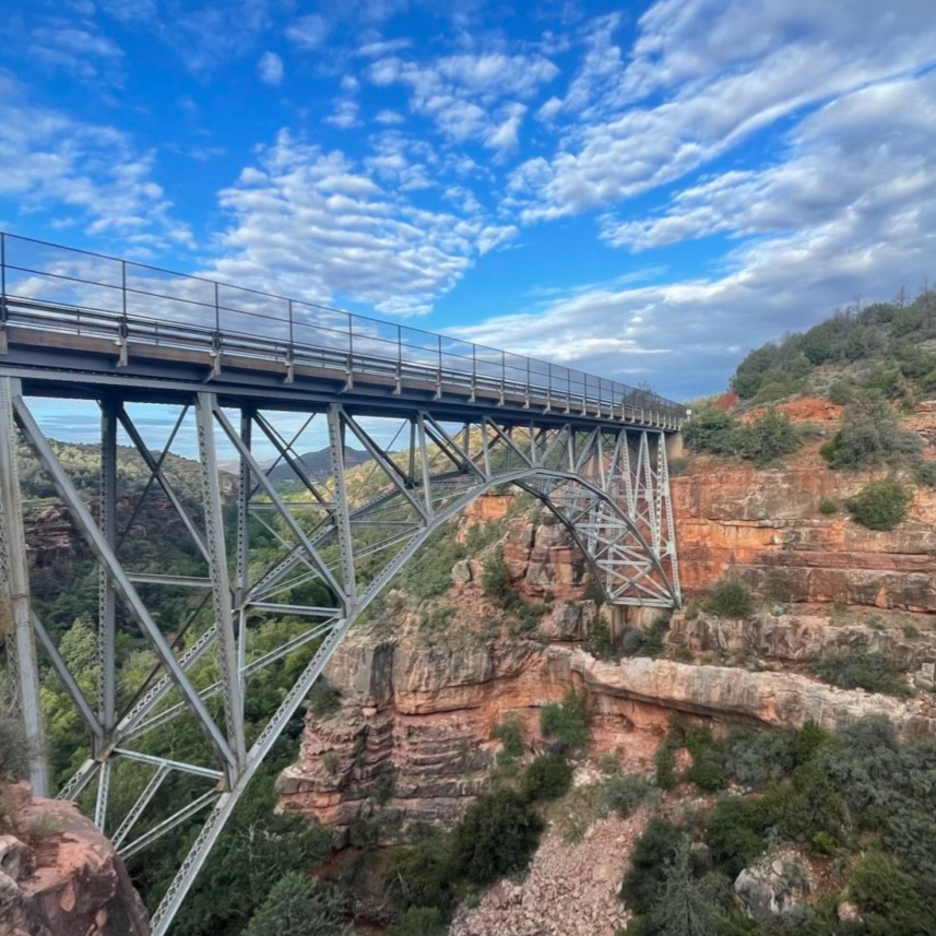
The last stop before you enter Sedona is the impressive Midgley Bridge. The historic bridge was built in 1939 and arches over the mouth of Oak Creek Canyon down below.
In my opinion, this overlook area is one of the most beautiful along State Route 89A, you really shouldn’t miss this one.
In addition to the overlook area offering incredible views of the bridge and surrounding canyon, you’ll also be at the trailhead for a few popular area hikes including the Wilson Canyon, Wilson Mountain, and Huckaby Trail.
If the parking here is full when you arrive, plan to come back another day. If you arrive early in the morning you’ll find plenty of parking. To clarify, by early I mean just before or just after sunrise.
Hours / Access: 24 hours
Parking Situation: There are about a dozen parking spots on a packed dirt parking area on the right hand side of the road. You will need a Red Rock Pass to park here.
Distance from Midgley Bridge to Sedona: About 3 minutes / 1.6 miles to city center
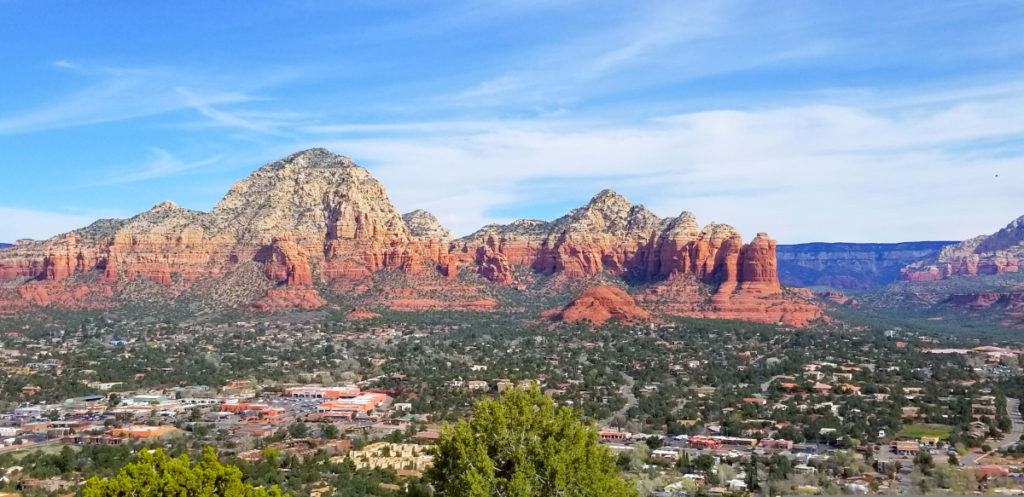
11. Sedona
It should be no secret by now if you’ve read my blog before, but I’m completely obsessed with Sedona and visit here quite often. In fact, over the years I’ve become somewhat of an expert on Sedona travel if I do say so myself.
That being said, I believe I make an excellent resource on all things Sedona. So if this will be your first visit to Sedona, I recommend checking out my Arizona Travel Page to see my other Sedona travel guides.
As I’m sure you’re already aware, Sedona is best known for its towering red rock formations. So many of the best things to do in Sedona involve outdoor activities liking hiking.
While the area offers many strenuous hiking options to beautiful overlooks, there are also many easy Sedona hikes to take advantage of with equally impressive views. One of my favorite easy hikes in the Bell Rock trail, which is a flat loop trail.
Other popular things to do in Sedona include hiking Cathedral Rock, visiting the Sedona wineries, watching the sunset from the Sedona Airport Scenic Lookout, and visiting Chapel of the Holy Cross, a beautiful Roman Catholic Chapel built into the surrounding red rocks.
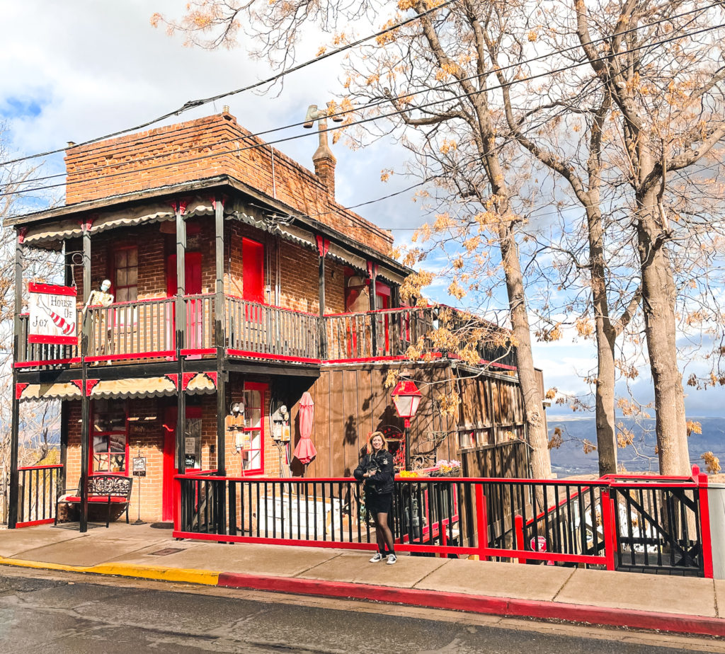
Those interested in visiting local historical sites can take day trips to Camp Verde to explore Montezuma Castle, a historic cave dwelling, or Jerome, a former mining town turned ghost town.
Taking a scenic drive through the city or joining one of the famous Jeep tours is also a great way to see the area without the need for more hiking.
Finally, if you’re an early riser like I am, I also suggest catching a Sedona sunrise while you’re in town. There’s nothing quite like seeing the early morning sunlight reflecting off those red rocks. Sunrise in Sedona is an experience you don’t want to miss.
In my opinion, your Sedona tour is not complete without sampling some of the city’s best restaurants. I highly recommend Elote Cafe or Cucina Rustica after a long day exploring the area. You’ll need reservations for Elote Cafe, so book this before your trip.
I hope this Flagstaff to Sedona road trip itinerary has helped inspire you to plan a road trip of your own. As always, thanks for reading.
Related Posts
Flagstaff to Sedona Road Trip Itinerary
The drive from Flagstaff to Sedona is one of the most beautiful drives in the…
Scottsdale to Sedona Day Trip Itinerary
10 Best Things to Do in Jerome Arizona
The best things to do in Jerome can all be enjoyed in one day or…
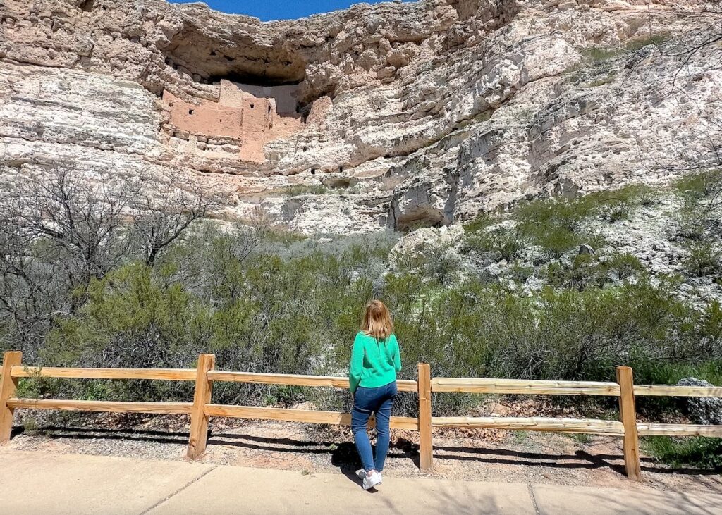
Montezuma Castle National Monument Travel Guide
This Montezuma Castle National Monument travel guide will help you plan your visit to this…
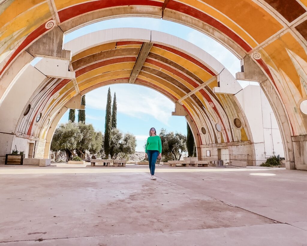
Things to do at Arcosanti Arizona
Arcosanti Arizona is one of the most unique and interesting cities in the Southwestern USA….
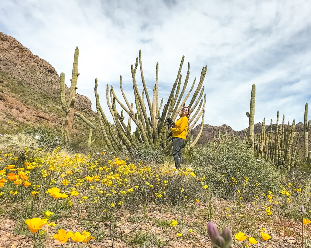
Organ Pipe Cactus National Monument Travel Guide
Organ Pipe Cactus National Monument is a must visit during an Arizona road trip. This…

Eden Fite
Solo Traveler | Dog Lover | Avoider of CrowdsI help busy people find creative ways to travel more.