
A Sedona sunrise is not to be missed. Yes, you’ll have to plan ahead and get up very early, but I promise you it will be so worth it.
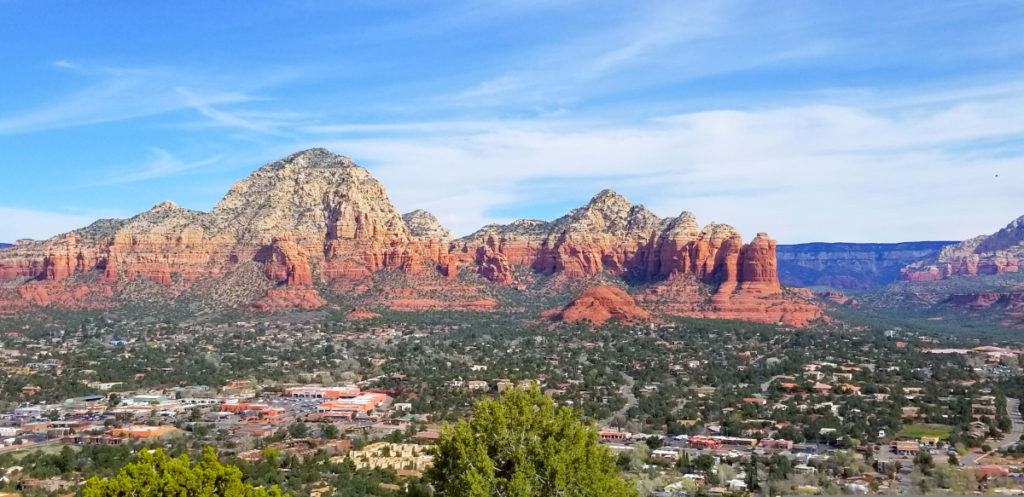
I’ve been to Sedona at least a dozen times and return every year for more. I love it here and always discover something new even after so many visits.
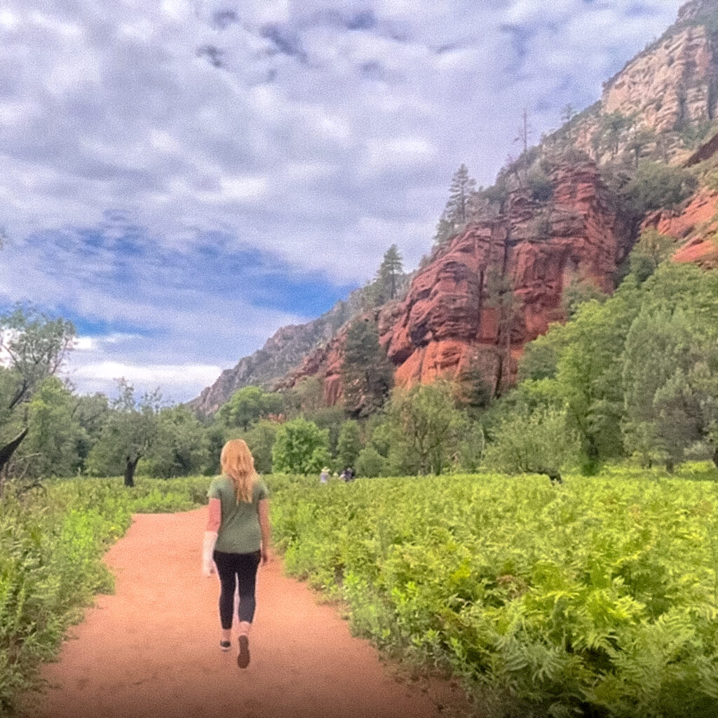
I honestly believe one of the best ways to enjoy this area is by exploring its many hiking trails. Sedona is a destination for outdoor lovers, and you’ll find no shortage of options to get outside while you’re here.
During my most recent visit, I spent an entire week on a Sedona sunrise tour seeking out the best Sedona sunrise spots around the area. Some were not as impressive as I had hoped, and others surprised the heck out of me.
For this post, you’ll find my 10 favorite spots to enjoy a sunrise in Sedona. I also include details about the location, how to get there, and what the parking situation is like.
Some of the links in the post are affiliate links. If you make a purchase through these links it helps to support this site at no extra cost to you.
Sedona Sunrise Spots Not to Miss
I selected each of the Sedona sunrise spots included in this post based on my own personal experience. I’ve been to Sedona over a dozen times and have hiked every single one of these trails. I can tell you with certainty, they are all incredibly beautiful places to enjoy a sunrise in Sedona.
I’ve included both challenging hikes and some that are pretty easy to get to. My hope is that no matter your skill or fitness level, you can find a few places to enjoy a sunrise during your visit to Sedona.
A quick note on parking. You’ll find small parking lots at most of the trailheads in and around Sedona.
Since this is a post about sunrise locations, theoretically you should be arriving at the trailhead early enough to beat the crowds. Which means there should be plenty of parking despite the small parking lots.
If you encounter a full parking lot, take a look to see if there is an overflow parking lot nearby. If there is, you will signs for it pointing you in the right direction.
Also, most of the parking lots at the trailhead locations will require you to purchase a Red Rock Pass. This is basically just a parking permit for the Sedona area.
If you’re in town a while, pick up the weekly pass which is $15. If you’re just here to enjoy one day in Sedona then I suggest purchasing the day pass for $5.
You’ll find a kiosk selling the Red Rock Pass at all parking locations. Credit cards are accepted. Be sure to place your parking pass on your dashboard before heading out on the trail.
Also, be sure to check the current Sedona sunrise time during your visit so you don’t miss it. Sunrise times obviously change throughout the year, so make sure you check before setting your alarm the night before.
Best Sunrise Locations in Sedona Arizona
Here is my YouTube video of my favorite sunrise locations around Sedona. I hope you enjoy the video.
I don’t include all of the sunrise locations included in this post, so be sure to scroll down so you can see all your options.
I post new travel videos every other Saturday, you are welcome to subscribe if you like.
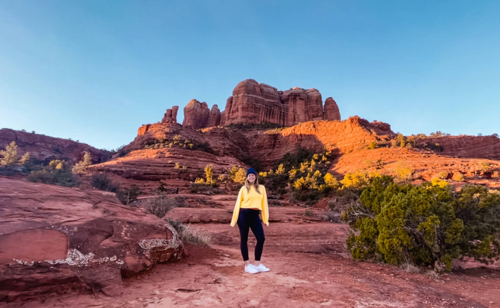
1. Top of Cathedral Rock Trail
One of my favorite hiking trails in Sedona also happens to be the perfect place to enjoy a sunrise in Sedona.
If you arrive early enough you’ll find you have most of the trail to yourself. Don’t worry though, you won’t be alone. There is always be a handful of people who were eager to catch the sunrise here as well.
What I love most about this trail is that it’s views all the way. From the moment you step foot on this trail you’re already staring up at Cathedral Rock, and it just gets better and better the closer you get.
While this is a mostly uphill hike and will definitely take your breath away in more ways than one, there are a million places to take a break and just enjoy the views along the way. Believe me, you won’t struggle to find a spot to relax and enjoy the views on this hike.
Once at the top, catch your breath, enjoy the views, and get some pictures. You’ll find a popular photo spot off to your right. You can see the spot I’m referring to pictured above. Just please be careful walking to this spot, the pathway is narrow and it’s a very long way down.
When you’re ready to head home, just make your way back down the way you came. But, if you have more energy in the tank, keep reading for my next favorite Sedona sunrise spot which is just a short walk, or climb, away.
Details for the Top of Cathedral Rock at Sunrise
Hot to find it: In Google Maps search “Cathedral Rock Trailhead.”
Trail length: 1.2 miles to the top. Total distance is 2.4 miles there and back.
Approximate duration: About 90 minutes to the top and back with minimal stops.
Parking: There are about a dozen spots right at the trailhead. If you arrive for sunrise you should find plenty of spots available. If the lot is full, follow the signs to the overflow parking just up the road.
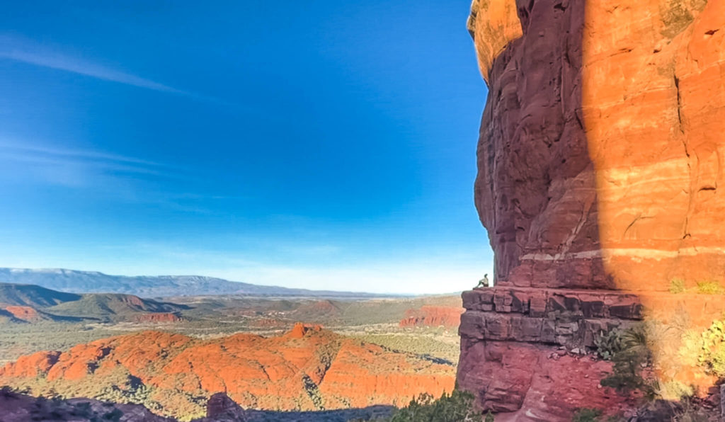
2. Spire at Cathedral Rock
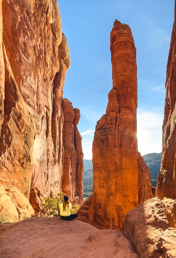
Since you’ve already made the 1.2 mile climb up to the top of the Cathedral Rock trail, what’s a little more climbing right?
Once you’ve taken in the views at the top of the trail, make your way to the left of the lookout area. You’ll find a narrow trail that leads up to the lookout spot pictured here.
Getting up to this spot requires a little climbing due to the steepness of the rocks, but no technical skills required. You just need to scramble up the rocks.
Once you reach this lookout spot, you may find you’re the only one there. Many visitors are unaware this spot exists, so if nobody sees you head this way, you’ll probably have it all to yourself.
I love this spot the most for the way the morning sunlight shines through and lights up the red rock. You’ve really got to see this one in person, the pictures don’t do it justice.
Once again, please be careful in this area, the rocks can be slippery and it’s a long way down. To get back to your car, you’ll have to go down the way you came. For the first part of the way down, stay low to the rocks and find those footholds you used when you went up.
Details for the Cathedral Rock Spire at Sunrise
Hot to find it: In Google Maps search “Cathedral Rock Trailhead.” At the top of the main Cathedral Rock trail, make your way to the left to find the pathway up to this viewpoint.
Trail length: 1.2 miles to the top. Total distance is 2.4 miles there and back.
Approximate duration: About 1 hour 45 minutes to the top and back with minimal stops. This includes the extra bit you’ll have to climb to reach this lookout.
Parking: There are about a dozen spots right at the trailhead. If you arrive for sunrise you should find plenty of spots available. If the lot is full, follow the signs to the overflow parking just up the road.
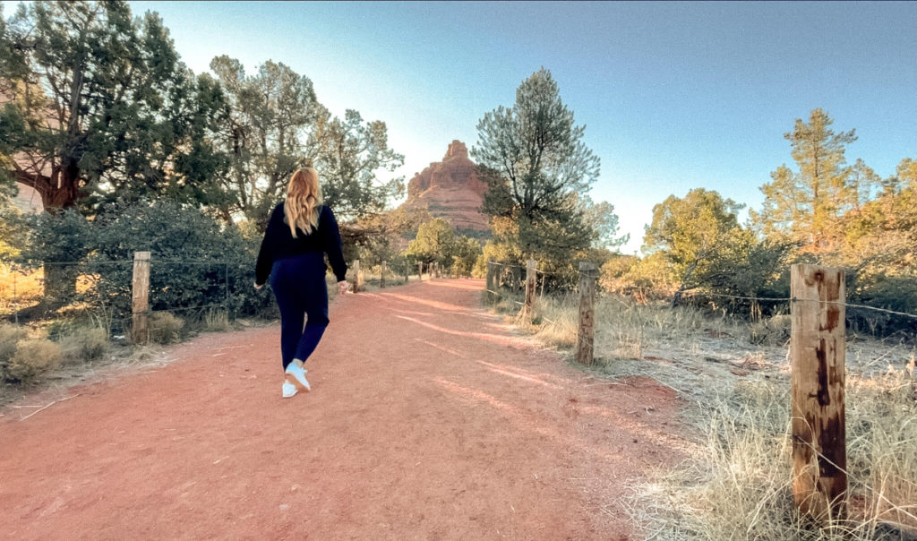
3. Base of Bell Rock
Bell rock is one of my most visited sites when I’m Sedona. I come here every single visit because I love it so much.
Bell Rock is one of the first red rock formations that greets you as you approach Sedona from Phoenix. So, when I see Bell Rock, I know I’ve arrived in Sedona.
The Bell Rock Climb is also one of the easiest hikes in the area that still requires a bit of uphill climbing. While yes, the uphill part is a bit strenuous, it doesn’t take long to get the base section of Bell Rock. It took me about 20 to 25 minutes to get to the base section from the parking area.
The base of Bell Rock is essentially a huge lookout platform and the views will knock your socks off. It’s gorgeous from up there.
If you’re particularly adventurous, you can keep hiking upwards. To get to the upper sections of Bell Rock you’ll need to do some scrambling over boulders. I didn’t go up that far on this hike.
Honestly, you do’t need to go up higher because the views from the base section are already incredible. But, it is a fun climb and a great workout if you aren’t afraid of heights.
Otherwise, take a seat on the base somewhere and enjoy the perfect Bell Rock Sedona sunrise.
Details for the Base of Bell Rock at Sunrise
Hot to find it: In Google Maps search “Bell Rock Trailhead.” You’ll notice there are two different trailhead parking areas. For a shorter hike, choose the northern parking area. If you’d like a longer hike, park in the southern parking area.
Trail length: From the northern parking area and trailhead it’s less than a mile (about .8) to the base section of Bell Rock. Total distance is 1.6 miles there and back. From the southern parking area it’s about an extra half mile or so.
Approximate duration: About 1 hour 45 minutes to the top and back with minimal stops. This includes the extra bit you’ll have to climb to reach this lookout.
Parking: There are about a dozen spots right at the trailhead. If you arrive for sunrise you should find plenty of spots available. If the lot is full, follow the signs to the overflow parking just up the road.
4. Bell Rock Loop Trail
The Bell Rock Loop Trail is the easiest to get to sunrise spot on this list. The trailhead meets right up with the parking lot, and the length of the 3.6 mile trail is mostly flat.
I like that just about anyone can enjoy this trail, and it offers some pretty fantastic views with minimal effort.
For the majority of the trail you’ll have the surrounding red rocks to look at, not to mention the iconic Bell Rock off in the background.
I think the Bell Rock Loop Trail makes a great sunrise location in Sedona because it’s hassle free to get to, and you’ll get to enjoy views of Bell Rock and nearby Courthouse Butte in the early morning sunlight.
Details for the Bell Rock Loop Trail at Sunrise
Hot to find it: In Google Maps search “Bell Rock Trailhead.” You’ll notice there are two different trailhead parking areas, one north of Bell Rock, one south of Bell Rock. Either one is fine.
Trail length: The Bell Rock Loop Trail is 3.6 miles and mostly flat.
Approximate duration: About 1 hour to 90 minutes depending on your speed.
Parking: There is plenty of parking at both the southern and northern parking lot areas.
Traveling Soon? Don’t forget your travel insurance.
- Travel insurance is now more important than ever.
- Travel insurance is probably less than you think it is. (Ex. For a week in Spain next month I’m paying less than $62.00.)
- Travel insurance covers a lot more than you think it does.
- It’s better to have it, than need it and wish you’d bought it.
- See for yourself. Check prices here.
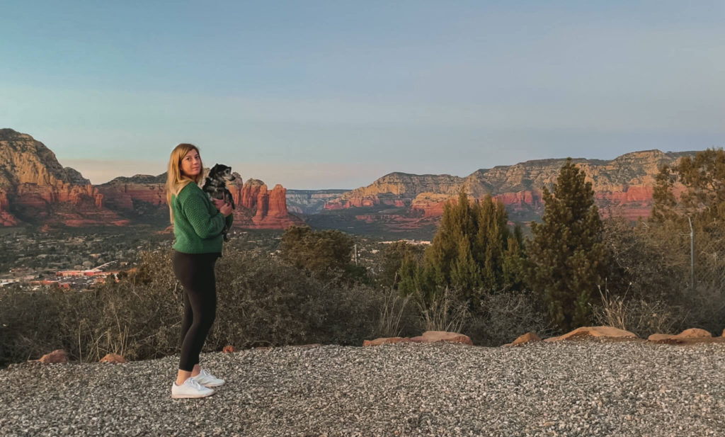
5. Sedona Airport Scenic Lookout
Okay, maybe this is actually the easiest sunrise spot in Sedona to get to since you’re only walking from the parking lot. But just because it’s easy to get to doesn’t mean it’s not just as impressive as some of the other spots on this list.
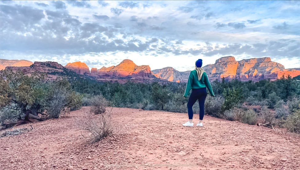
From this lookout you’re standing at the top of Airport Mesa, otherwise known as Tabletop Mountain. Here you’ll experience one of the most incredible views Sedona has to offer with the iconic red rock formations off in the distance along with the surrounding city landscape and nearby Verde Valley.
What I love most about the Sedona Airport Scenic Lookout at sunrise is that you’re at a higher elevation than most other sunrise spots in the area. This gives you a birds eye view of Sedona at sunrise where you can see the morning sunlight light up the sky and surrounding red rocks.
If you’ve spent any time in Sedona before, you may also know that many sunrises here come with vivid pink hues across the sky. It’s worth getting up for, seriously.
If you’re not much of an early riser you can also enjoy the sunset from here. In fact, this is one of the best sunset spots in Sedona. As the sun sets behind you it lights up the red rock formations off in the distance making them a bright gold color.
It’s really cool to see this in person, but you’ll be sharing this moment with about 100 other people since it’s so easy to get to and so popular.
For those that prefer not to stand around in one place, you can find the highly trafficked Sedona Airport Loop trail nearby. This is a mostly flat 3.2 mile loop. It’s on the rocky side but is otherwise a fairly easy trail.
Parking for the Sedona Airport Loop Trail is located down Airport Road. For driving directions use Google Maps to search “Airport Mesa.”
Along this trail you’ll also come across the Airport Mesa Vortex, which is also visible on the map if you’d like to stop by.
Details for the Sedona Airport Scenic Lookout at Sunrise
Hot to find it: In Google Maps search “Sedona Airport Scenic Lookout” to obtain driving directions.
Trail length: None. This is a lookout point with nearby parking.
Approximate duration: As long as you wish to be there.
Parking: The parking lot for the lookout area is huge. There is an attendant in the booth collecting parking fees which are $3 per vehicle.
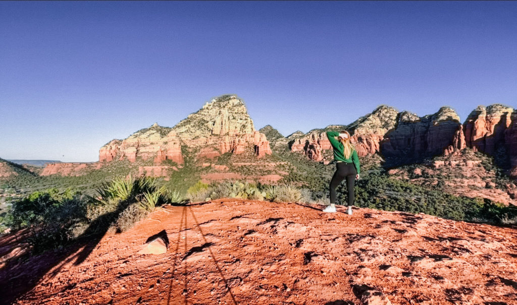
6. Sugarloaf Mountain
Sugarloaf Mountain surprised the heck out of me and ended up being my favorite sunrise hike of the week. Perhaps this was because I pretty much had the place to myself, including the summit.
In the two hours that I was out hiking and enjoying the views at Sugarloaf Mountain I saw a total of 5 people. This was two couples and one person who was running the trails, most of whom left when I was arriving.
To get to the summit of Sugarloaf Mountain you’ll take the Teacup Trail from the parking lot towards the Sugar Loaf Loop Trail. After about a quarter mile (0.3 miles actually) you’ll come to a fork at Thunder Mountain Trail, but keep right to continue towards Sugar Loaf Loop.
After a short while longer, you’ll come to another fork in the trail where the Teacup Trail meets the Sugar Loaf Loop Trail. Follow the signs to the Sugar Loaf Summit Trail.
To reach the top of Sugarloaf Mountain you’ll climb 250 feet to the summit. It’s kind of steep but not that long. You can stop to catch your breath just about anywhere on the trail, slow and steady.
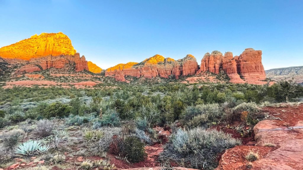
Once at the summit you get gorgeous 360 degree views of Sedona. There’s a good chance you might have the place all to yourself.
When the weather is right, you may also get to watch the hot air balloons sailing by off in the distance. They’ll basically float right past you and land behind the red rocks.
If you’re looking for another hike in Sedona similar to this one, you can also check out nearby 1.5 mile Doe Mountain Trail. If looking for a significantly longer trail, check out the 7.3 mile Boynton Canyon Trail.
Details for Sugarloaf Mountain at Sunrise
Hot to find it: In Google Maps search “Sugar Loaf Trailhead” to obtain driving directions.
Trail length: 1.9 miles for the full Sugarloaf Loop Trail. Otherwise about 1 mile to summit and back.
Approximate duration: About 90 minutes if you enjoy the views along the way.
Parking: The parking lot here has about a dozen spots. You’ll find plenty of parking at sunrise.
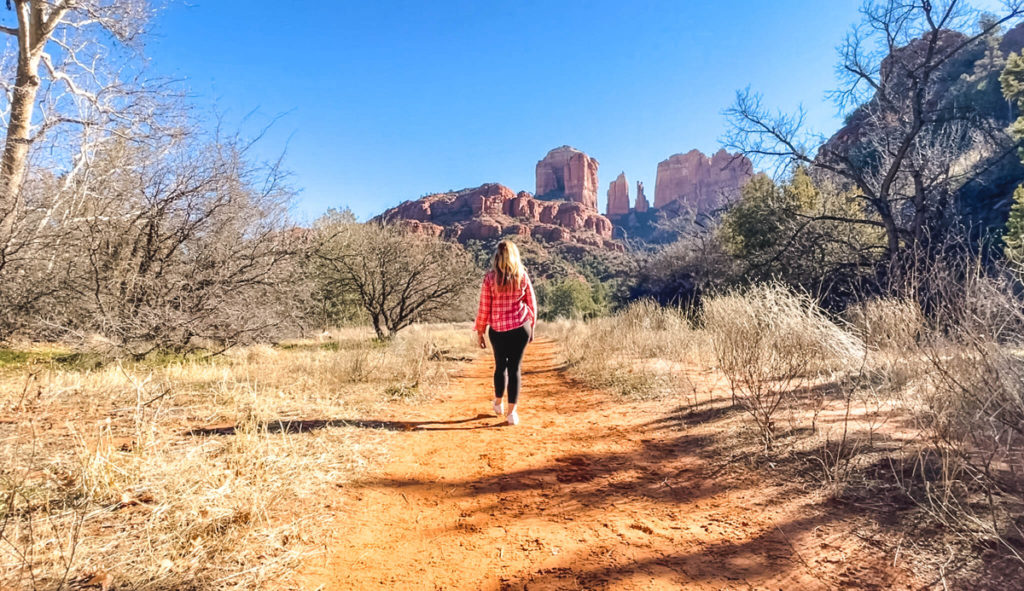
7. Red Rock Crossing Trail
You can access the Red Rock Crossing Trail near the town of Oak Creek, which is just south of Sedona.
In fact, Oak Creek is where I like to stay when I visit Sedona. Oak Creek tends to be less crowded, a bit more affordable, and it’s very close to Bell Rock and the Red Rock Crossing Trail. I’ll provide a few suggestions for places to stay down below.
So the easiest way I’ve found to get to the Red Rock Crossing Trail is to park at the Baldwin Trail Trailhead (information on this below). After parking, just walk down Verde Valley School Road until it dead ends. At the dead end, look to the right and you’ll see where the trail is.
Basically, you’ll just keep walking to the right. The trail is not clearly defined in this area because of the red rock, but you can use your Google Maps to keep on the trail. Just a short while down, the trail becomes more defined.
From where you entered the trail at the end of Verde Valley School Road it’s 1.5 miles to meet up with the Cathedral Rock Trail, then another 0.3 miles to the top of Cathedral Rock. So round trip you’re looking at 3.6 miles if you hike to the top of Cathedral Rock.
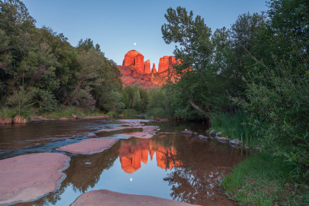
What I love about this trail is that you’re walking along the side of Oak Creek, which is beautiful in the morning light. After a while you’ll come across the open area pictured above where you get perfect views of Cathedral Rock.
Details for Red Rock Crossing at Sunrise
Hot to find it: In Google Maps search “Baldwin Trail Trailhead” to obtain driving directions.
Trail length: 3.6 miles if climbing to the top of Cathedral Rock. Otherwise an easy 3 miles if just hiking to where the trails meet.
Approximate duration: About 2 hours, maybe more if you enjoy the views along the way.
Parking: The parking lot here has about a dozen spots. Red Rock Pass required. You’ll find plenty of parking at sunrise. Also, you’ll need to drive along an unpaved section of the road to get to this parking area. Just about any vehicle will be fine on this road, just go slow. I drive a little Fiat and my car did just fine.
8. Oak Creek at Crescent Moon Picnic Site
This is perhaps the best sunrise in Sedona if you’re not looking to do any hiking. You can reach Oak Creek via the paved walking paths at Crescent Moon which is just a short distance from the parking area.
The best reason to visit Oak Creek instead of any of the other spots on this list is for those gorgeous reflections of nearby Cathedral Rock on the water.
In fact, this is the perfect place to try out some Sedona sunrise photography. Since it doesn’t involve hiking you won’t have to drag your gear very far.
Photographers will find plenty of great photo opportunities along Oak Creek, especially in areas where the water is calm.
For full transparency, the Crescent Moon Picnic Area does not open until 8:00 a.m. which means you cannot actually access this area at sunrise. There is no other parking in the area, so plan to arrive right when they open.
That being said, if you arrive at 8:00 a.m. you’ll still have time to enjoy the views and get photos during golden hour.
Details for Oak Creek via Crescent Moon at Sunrise
Hot to find it: In Google Maps search “Crescent Moon Picnic Site” to obtain driving directions.
Trail length: N/A
Approximate duration: However long you wish to be there.
Parking: There is plenty of parking here. Be advised the parking area does not open until 8:00 a.m. There is also an $11 parking fee.
9. Mezcal Trail
This is an easy and very pretty Sedona sunrise hike that can be done by just about anybody. It’s also one of my favorites. Seriously, I loved this trail and can’t express strongly enough how beautiful the views are at sunrise. It’s gorgeous.
The trail is mostly flat but I promise it packs a lot into it’s relatively short distance.
You’ll find plenty of spots along the way with great views of the massive red rock range off in the distance.
In fact, I loved the views along this trail so much I missed sunrise at Devil’s Bridge, which is where this trail leads.
We’ll talk more about Devil’s Bridge down below. For now, if you’re looking for an easy to reach and easy to hike trail to enjoy a sunrise in Sedona Arizona this is the trail for you.
Details for Mescal Trail at Sunrise
Hot to find it: In Google Maps search “Mescal Trailhead” to obtain driving directions.
Trail length: Approximately 1.2 miles round trip.
Approximate duration: About 1 hour or so if you enjoy the view.
Parking: The parking lot here has about two dozen spots. You’ll find plenty of parking at sunrise, but don’t be late.
10. Devil’s Bridge
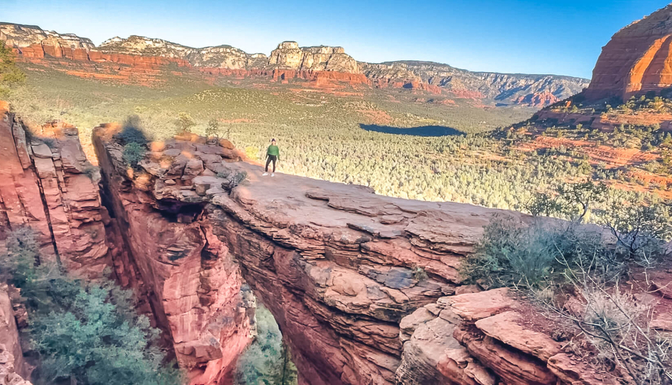
Devil’s Bridge is one of the most popular hiking trails in Sedona and for good reason. The views here are amazing and being able to get cool photos from the red rock bridge pictured above is a big draw.
To get to Devil’s Bridge, you’ll need to hike the moderately difficult Devil’s Bridge Trail. From the Devil’s Bridge Trailhead it’s 0.9 miles and 400 feet in elevation gain to the top at Devil’s Bridge.
Now the problem is, you can’t reach the Devil’s Bridge Trailhead parking area without a high clearance or 4×4 vehicle. If you have one of these, or plan to rent one, you can simply park in the dirt lot at the Devil’s Bridge Trailhead and be on your way.
If you have a regular car or SUV, you actually have an even better option, the Mescal Trail which I talk about above. You’ll find the Mescal Trailhead and parking area along Long Canyon Road.
From the Mescal Trailhead it’s 1.2 miles to the Devil’s Bridge Trailhead. This route actually takes you on the Mescal Trail and Chuck Wagon Trail, but either way, it’s 1.2 miles and it is absolutely beautiful.
In fact, in many ways I think the Mescal Trail at sunrise is more beautiful than Devil’s Bridge, but don’t tell anyone I said that.
So, from the Mescal Traihead to the top of Devil’s Bridge you’ll be hiking 2.1 miles and it’s absolutely worth it.
One of my best hiking tips for seeing Devil’s Bridge at sunrise is to keep it moving. Ideally you want to beat the crowds at the top of Devil’s Bridge.
During my recent visit I kept stopping to take photos along the Mescal Trail. So when I finally arrived at the top of Devil’s Bridge, there were at least 30 other people at the top and 10 in line for a photo.
I waited in line for approximately 30 minutes before it was my turn, so about 3 minutes for each person. For a more enjoyable and peaceful experience, try to beat these crowds.
I would aim to be at the Mescal Trailhead by 6:30 a.m. if at all possible.
Details for Devil’s Bridge at Sunrise
Hot to find it: In Google Maps search “Mescal Trailhead” to obtain driving directions.
Trail length: Approximately 4.2 miles round trip.
Approximate duration: About 2 hours depending on crowds at the top of Devil’s Bridge.
Parking: The parking lot here has about two dozen spots. You’ll find plenty of parking at sunrise, but don’t be late.
Where to Stay in Sedona
If you’re looking for a place to stay in Sedona you’ll find no shortage of options.
Since Sedona is such a popular destination you can expect high priced accommodations. However, there are budget friendly options if you look for them. You can also find great deals if you travel in the off season or shoulder season.
Here are a few places I’ve stayed at and liked:
- Hilton Sedona Resort at Bell Rock: Comfortable rooms with a microwave and refrigerator. They also have a nice restaurant and bar area complete with fire pits to make Smores. This resort is in Oak Creek right down the road from Bell Rock and one of the city’s best Italian restaurants, the one and only Cucina Rustica.
- Element Sedona: No frills here but it’s a newer hotel with a pool and is also in Oak Creek and close to Bell Rock. I’ve found good rates here on occasion, around $200 night but that’s not always the case. This is also a good option for Marriott rewards members. It’s a category 6 hotel and a quick check of random dates in February are selling at $260/night at the time of publication.
- Enchantment Resort: If you’re not on a budget and want to stay somewhere nice. This resort is located just outside Sedona near some of the area’s best hiking spots, including many mentioned above in this post.
- L’Auberge de Sedona: This is another upscale property but located right in the heart of Sedona. This is a beautiful property located right along Oak Creek. If I’m being honest, if I had the budget for it, this is where I’d stay.
I hope you’ve enjoyed this guide to the best sunrise spots in Sedona. If you’re looking for more information on things to do in Sedona and Arizona, have a look at my other Arizona content down below. Thanks so much for reading.
Related Posts
Flagstaff to Sedona Road Trip Itinerary
The drive from Flagstaff to Sedona is one of the most beautiful drives in the…
Scottsdale to Sedona Day Trip Itinerary
10 Best Things to Do in Jerome Arizona
The best things to do in Jerome can all be enjoyed in one day or…
Montezuma Castle National Monument Travel Guide
This Montezuma Castle National Monument travel guide will help you plan your visit to this…
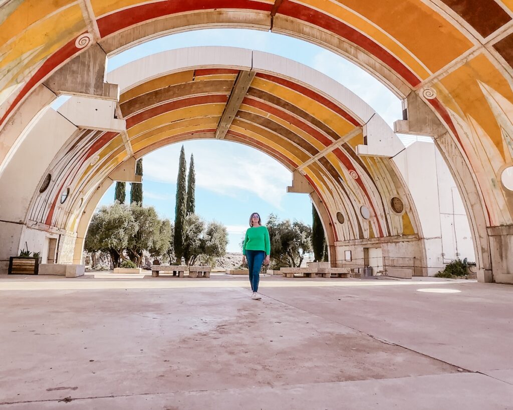
Things to do at Arcosanti Arizona
Arcosanti Arizona is one of the most unique and interesting cities in the Southwestern USA….
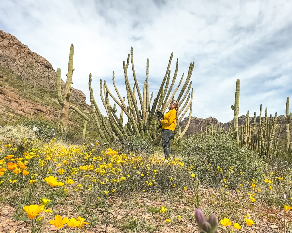
Organ Pipe Cactus National Monument Travel Guide
Organ Pipe Cactus National Monument is a must visit during an Arizona road trip. This…

Eden Fite
Solo Traveler | Dog Lover | Avoider of CrowdsI help busy people find creative ways to travel more.